8 days into a Pacific Northwest road trip, I wake up before the crack of dawn in a rest area outside of Tacoma. Even though the next stop is Seattle, I’m only about an hour away and check-in isn’t until 3 PM. Scanning the surrounding area on Google Maps, I notice mountains to the east and my eyes narrow in on one location: Mount Rainier National Park.
Here’s Mount Rainier – Where to Find the Best Views:
Mount Rainier
Mount Rainier National Park
At 14,410 feet, Mountain Rainier is the tallest volcano in the Cascade Mountain Range and the most glaciated peak in the entire United States. Mount Rainier National Park is the nation’s 5th oldest, with roads, buildings and other structures still standing after over 100 years. Every year, nearly 2 million people from around the world come to visit this iconic place.
Mount Rainier from Tipsoo Lake
Getting to Mount Rainier
Located about 60 miles southeast of Seattle, a visit to Mount Rainier proves to be an easy day trip from the Puget Sound. Multiple tour companies offer excursions to the park or renting a car to explore on your own is the most favored option.
Mount Rainier
Finding the Best Views of Mount Rainier
Sunrise Side
The Sunrise Side of Mount Rainier is higher and drier than any other place in the park. At 6400 feet, it’s the highest elevation you can drive on. Hence the name, this area gets more sun than the other parts of the park, allowing for longer seasons to explore.
Twisting around pine trees and running parallel with the White River, WA-410 (Mather Memorial Parkway) takes you directly to the Sunrise Side of Mount Rainier National Park.
Since this road closes seasonally, check the NPS website here for current conditions
Mount Rainier
Sunrise Visitor Center
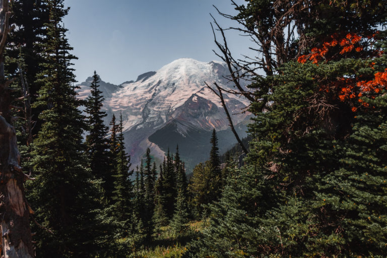
After passing over the Crystal Creek on WA-410, take a right towards the White River Entrance where you’ll pay the National Park Fee. If you’re visiting from July to October, take this road 3 miles west until you can take a right for Sunset Ridge.
This 10 mile drive up to the Sunrise Visitor Center is one of the most scenic in all of Washington. As the road figure-8’s itself from north to south, with every other turn you get the most incredible views of that monstrous snow-tipped mountain.
Mount Rainier
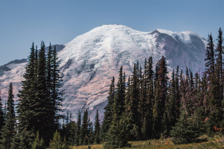
While there are multiple pull-offs here for some epic views, the best landscape is found at the road’s end at the Sunrise Visitor Center.
Upon parking, you’ll see a number of people coming from the southwest on trails. Follow this pathway down 0.25 miles until the trees clear out, opening up to the massively snow-capped peak.
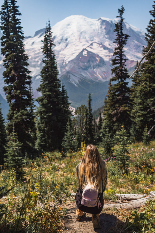
Mount Rainier Views
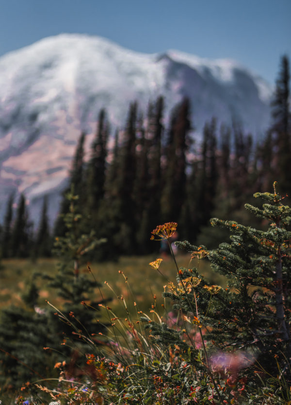
One of my favorite things about the Sunrise Side of the park is the morning warmth allowing wildflowers to grow. Visiting in late August, the purple florals still decorated the ground. What a perfect little detail to add in front of that stunning back drop.
Wildflowers in the front of Mount Rainier
If you’re looking to enjoy a more in-depth hike, this is the perfect place to take off from. The Sunrise Side offers 7 different trail heads, ranging in distances of 1 mile to 11 miles. Follow the link here to read more about the different hikes.
Since we didn’t have much time before getting to Seattle, we only walked about a half mile down Emmons Vista. On the way back down Sunset Ridge, stop at the pull outs for some more spectacular views of Mount Rainier.
Mount Rainier
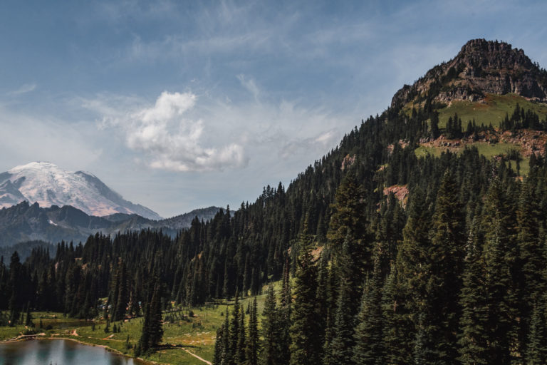
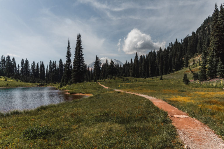
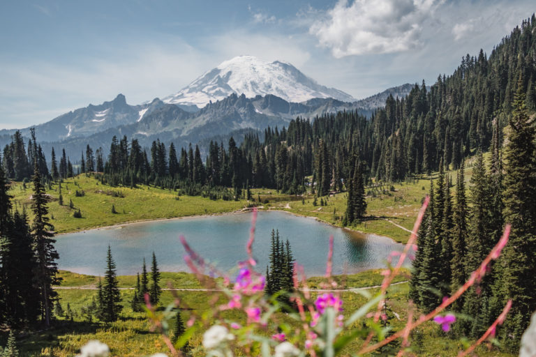
Tipsoo Lake
After coming down the 10 mile Sunset Ridge, retrace your steps by taking a left turn. Heading east past the White River Entrance, turn right on to WA-410. Drive for 3 miles until you can take a left hand turn at Cayuse Pass. Within 2 miles you’ll reach the parking area for Tipsoo Lake on the left hand side of the road. On the north side of the parking lot, multiple foot trails can be seen. Take this route to get to the other side of Tipsoo Lake.
Mount Rainier from Tipsoo Lake
In the summertime, millions of wildflowers dot the ground around Tipsoo Lake, reflecting Mount Rainier in the water.
A couple of popular trails start from the Tipsoo Lake area. The Naches Peak Loop is one of the most popular in Mount Rainier National Park. A portion of the Pacific Crest, running 2,659 miles from Canada to Mexico, can be accessed from the parking lot. Yakima Peak rising above Tipsoo Lake has a hiking trail to the top as well.
Mount Rainier from Tipsoo Lake
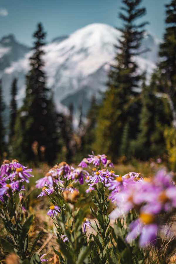
Chinook Pass
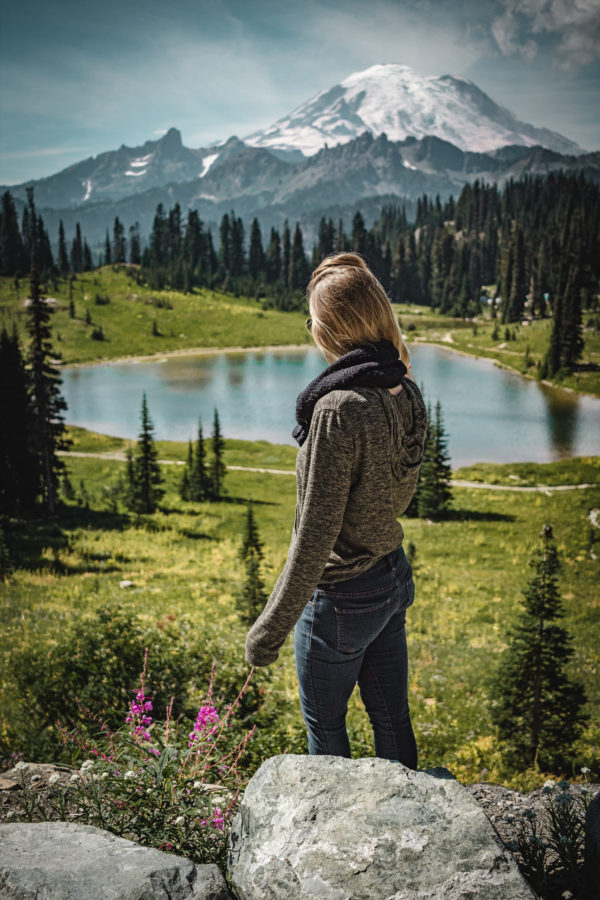
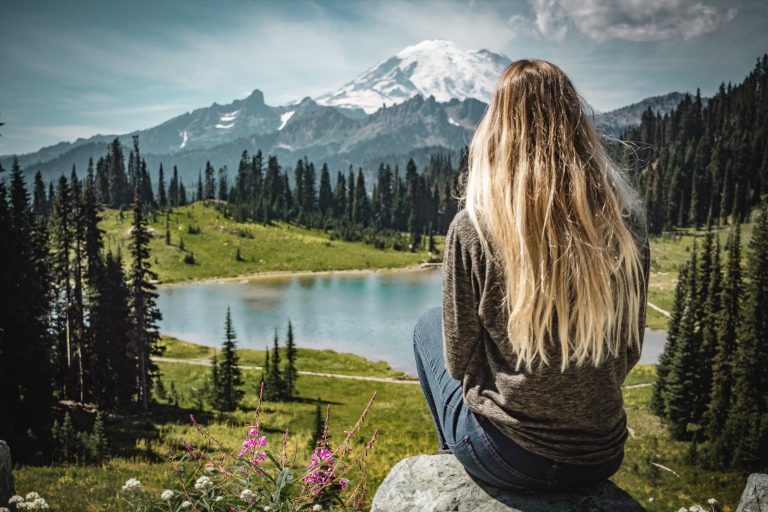
You won’t have to go too far for my favorite views of Mount Rainier. Get back in your car and take a left up around the bend. After a quarter mile, you reach an elevation of 5,432 feet at Chinook Pass.
Me on a rock in front of Mount Rainier
Chinook Pass rises above Tipsoo Lake with colorful wildflowers popping up in front of the pine-treed scenery. The views from here are so otherworldly, it’s like a Bob Ross painted picture. I could’ve sat here all day in silence staring out at the postcard-worthy shot of Mount Rainier.
Victor Steinbrueck Park
If you’re in Seattle with clear weather conditions, head down to the Pike Place Market area. On the north side, walk over to Victor Steinbrueck Park. Down the steps overlooking WA-99 look to your left past the piers and the Seattle Great Wheel.
Do you see it? The tippy top of Mount Rainier, over 60 miles away, peeks out over the CenturyLink Field.
Me in Seattle and views of Mount Rainier in the distance
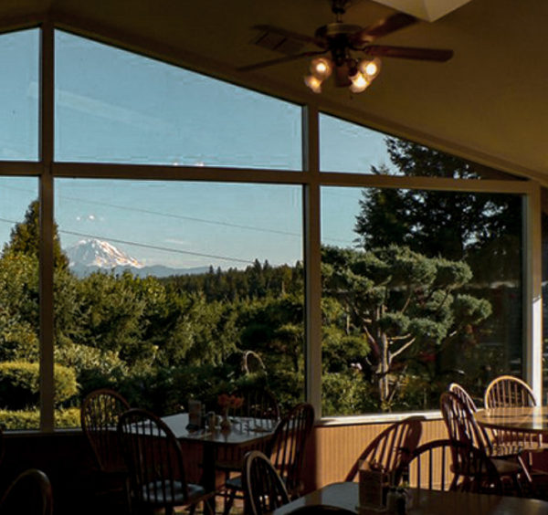
The Black Diamond Bakery
On your way out of Seattle, take the I-5 to I-405E before veering off of WA-169 for 18 miles. The Black Diamond Bakery, established in 1902, supplies some incredible views of Mount Rainier. On a a clear day, you can see the snow-capped peak through the floor to ceiling window in their dining room.
View of Mount Rainier from the Black Diamond Bakery windows