When we think of Puerto Rico, images of sun-drenched beaches, vibrant culture, and lush rainforests often come to mind. But beneath the sparkling turquoise waters, just a short distance north of the island, lies a colossal and enigmatic geological wonder: the Puerto Rico Trench. Often referred to informally as “The Pit of Puerto Rico,” this underwater depression holds the deepest point in the entire Atlantic Ocean and tells a dramatic tale of Earth’s ancient, relentless forces.
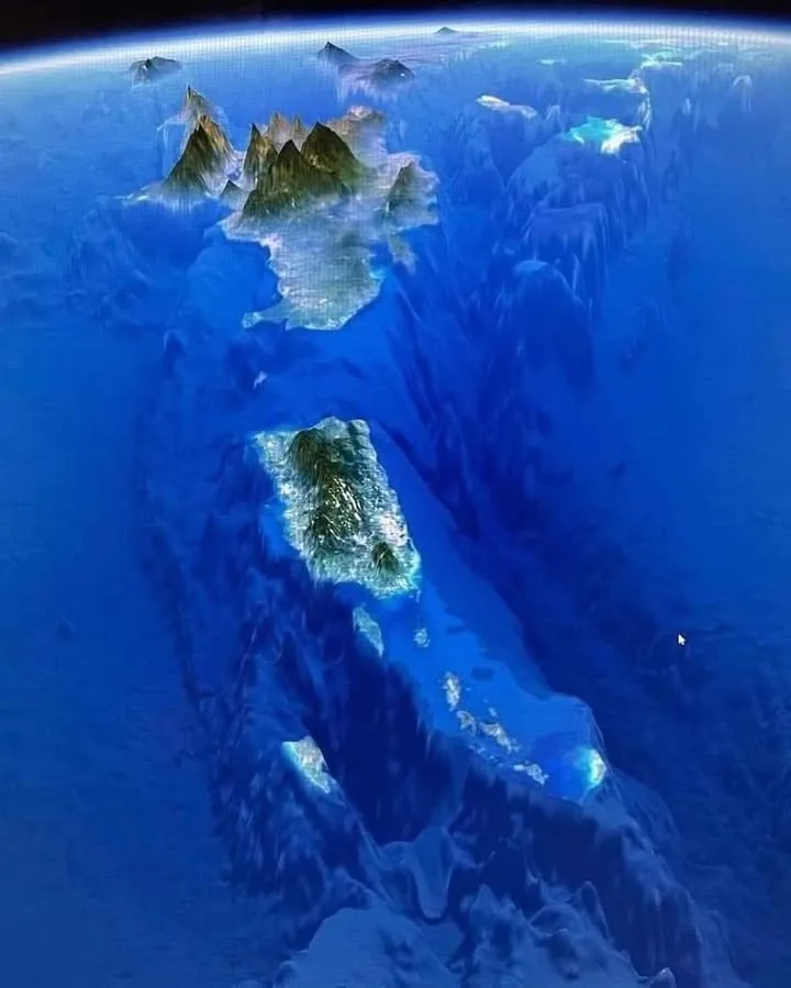
Stretching an astonishing 1,090 miles (1,750 km) long and approximately 60 miles (100 km) wide, the Puerto Rico Trench is a truly monumental feature. To put that into perspective, it’s roughly the distance from New York City to Miami, all submerged beneath the ocean’s surface. And within this vast trench lies its most profound secret: the Milwaukee Deep.
Located about 100 miles northwest of Puerto Rico, the Milwaukee Deep plunges to an astounding 27,493 feet (8,380 m) below sea level. Imagine stacking nearly five Empire State Buildings one on top of the other, and you still wouldn’t reach the bottom! This makes it the absolute deepest point in the vast expanse of the Atlantic Ocean, a world of crushing pressure and eternal darkness that few, if any, human eyes have ever witnessed directly.
The story of the Puerto Rico Trench isn’t a recent one; its origins date back to the very beginning of the Cenozoic Age, around 65 million years ago. For seventy million years, this colossal chasm has been forming, a silent testament to the dynamic interplay of Earth’s tectonic plates.
It’s part of a larger, complex system of strike-slip faults in the northern Caribbean, where the North American plate is slowly but relentlessly sliding beneath the Caribbean plate. This immense geological ballet, unfolding over millions of years, has sculpted the trench into what we see today – a deep scar on the ocean floor, partially filled with the sediments of eons.
While inaccessible to most, the Puerto Rico Trench is a vital area of study for oceanographers and geologists. It holds clues to our planet’s past, provides a unique habitat for deep-sea life, and continues to be an active area of seismic interest. Its immense depth and long history remind us that even in regions we think we know well, there are still profound mysteries hidden just beneath the surface.
So, the next time you gaze out at the beautiful Caribbean Sea, remember the incredible “Pit of Puerto Rico” lurking below – a testament to the raw power and enduring grandeur of our planet.
READ MORE: Exploration of the Puerto Rico Trench in the mid-twentieth century: Today’s significance and relevance
Abstract
The Puerto Rico
Trench is a deep oceanic subduction zone that runs parallel with the northern coasts of Puerto Rico and the Dominican Republic. It is the deepest place in the Atlantic Ocean with a maximum depth of approximately 8400 m. Discovered by the HMS
Challenger Expedition in 1875, the depth of the trench increased multiple times in the ensuing 100 years with the onset of sonar usage. It is perhaps unique among the world’s deep trenches in that a series of unrelated but equally pioneering expeditions captured the true biological and geological characteristics of one of the deepest places in the world, observations that are still highly relevant today. Multiple deep water trawling campaigns and surveys using drop cameras and exploratory dives in a deep diving submersible provided great insight into the morphology of the trench, the types of habitat within the trench, the substrate, the food supply, and the diversity of species that inhabit these extraordinary depths. Many of these accounts are obscure and disparate, yet combined bear a remarkable similarity to recent work in other trenches. These unique and insightful accounts are collated and retold here alongside recent and comparable findings to contextualise these discoveries, prevent them from being forgotten, and keep the efforts of those involved to remain relevant as we continue to explore the deepest places of the world’s oceans.
Introduction
The hadal zone is a term used by marine biologists to describe the marine living space, or the biological transition that exceeds 6000 m in water depth. It was a term coined by Dr. Anton F. Bruun (1901–1961), leader of the Danish RV Galathea Expedition in the 1950s, following a round-the-world sampling campaign that first systematically targeted the very deepest of places, the subduction trenches.1 The name is derived from the Greek God of the Underworld Hades, and was chosen in accordance with the other biozones: littoral (0–200 m), bathyal (200–3000 m) and abyssal (3000–6000 m). Its first introductory paper was written in 1959 by Dr. Torben Wolff (1919–2017), also a member of the RV Galathea Expeditions.
The history of biological sampling at the great depths of the oceans can be loosely divided into two eras. The first era was largely the work of the RV Galathea and the Soviet RV Vityaz expeditions (also 1950s) who were famed for the sheer scale of their expeditions, although many other expeditions also contributed valuable knowledge of extreme depths worldwide.3 Following the 1950s and 1960s there was a hiatus of hadal exploration for reasons that are unclear, perhaps funding, technological plateauing, or simply alternative national interests. This first era of hadal exploration was summarised twice by a prominent member of the Vityaz expedition Georgii Mihailovich Belyaev (1913–1995) of the P.P. Shirshov Institute of Oceanology in Moscow.
The second era of hadal exploration began with the Japanese ROV Kaikō coming into use in the mid-1990s, followed approximately 10 years later by a series of lander-based studies and several new vehicles being used: the Hybrid Remotely Operated Vehicle (HROV) Nereus; the deep-diving submersible DeepSea Challenger; and other technologies emerging now. During this second phase, the first book in 25 years dedicated to hadal science was written, and more recently, the first round-the-world expedition focusing on trenches since the 1950s took place. The Five Deeps Expedition (2018–2019) successfully deployed a two-person submersible to the deepest place in each of the five oceans. This expedition’s research and the writing of the book created an increased amount of historical research and collation of images, samples, and stories from every trench. The space dedicated in the book to the Puerto Rico Trench began to set it apart from some of the more well-known trenches.
The Puerto Rico Trench appeared to be interesting because of some remarkably similar findings to those being made in modern exploration. The trench is underpinned by years of pioneering hydrographic surveys sounding ever greater depths, plumbing the seafloor in pursuit of what was emerging to be the deepest place in the Atlantic Ocean. The years spanning 1948–1973 were particularly remarkable in that the trench was defined by what was an extraordinary series of sampling and exploration pursuits, from trawling to submersibles. For example, many of the deepest trawls of the time came from this trench, including the record for the deepest fish. Other expeditions used deep-sea drop cameras in pursuit of establishing what the seafloor of the trench actually looks like beyond simple bathymetry. There were also pioneering manned submersible dives, which even today are rare at these depths, which undertook hydrographical, geological, and biological surveys which go largely unnoticed in today’s literature. The Puerto Rico Trench also had its fair share of anthropocentric controversy as a result of industrial scale waste disposal found at those depths.
Reading through the collated accounts of these otherwise disparate studies spanning nearly two decades in the mid-twentieth century (Table 1), it instinctively feels that this work done over half a century ago mirrors exactly where we are today as a hadal science community. This is a slightly self-deprecating statement to those of us still researching hadal depths, but also is a fascinating celebration of like-minded individuals from a different era who were clearly thinking the same thing. The Puerto Rico Trench is a place that exemplifies this cross-pollination of generations who tried, and are still trying, to figure out what goes on in the deepest parts of our oceans.
Section snippets
Discovery
The Puerto Rico Trench, located off the northern coasts of Puerto Rico and the Dominican Republic and extending northeast of the Leeward Islands, was first discovered on the HMS Challenger Expedition on the 26 March 1875. Captain Sir George S. Nares (1831–1915) sounded a depth of 3875 fathoms (7087 m) at approximately 19° 42′N, 65° 07′W (Fig. 1). Its first map, “The Physical Chart of the World showing the track and soundings of H.M.S. Challenger 1873–1876,” by Sir John Murray (1841–1914) was
Trench morphology
The morphology of the Puerto Rico Trench, what we now know is a subduction trench, is an elongated, asymmetrical V-shaped depression running east-west parallel to the north coasts of the Dominican Republic and Puerto Rico, and extends eastwards towards 60 °W at a location northeast of the Leeward Islands. The deepest point is located in the vicinity of the boundary of the Exclusive Economic Zone (EEZ) of the Dominican Republic and Puerto Rico (19°36.78′N, 67°50.82′W). Details of the internal
Exploration
Between 1948 and 1973, the Puerto Rico Trench was host to a series of ground-breaking exploration campaigns. Unlike many other deep trenches, the Puerto Rico Trench was explored for a multitude of reasons using pioneering equipment from ultra-deep bottom trawls, drop cameras, and manned submersibles, all cutting-edge technologies for their time.
In addition to human exploration and remote imaging of the seafloor, there were several expeditions that set out to trawl the deepest parts of the
Habitats
Jean-Marie Pérès’ account of the actual seafloor did not go much beyond the colour and texture of the sediment, however other dives in the Puerto Rico Trench for geological observation by Robert Dill did manage to image the terrain. Three dives on Deepscan deliberately targeted a very steep, almost vertical section on the southern slope with comparative dives on the slightly less steep northern slope. These escarpments in the south offered a cross-section through three distinctive layers,
Biology
The trawling campaigns of the RV Albatross, RV Vema, RV Chain, RV John Elliott Pillsbury, RV Anton Bruun, and RV Akademik Kurchatov collectively obtained samples of 35 diverse benthic species from hadal depths (1 polychaete, 1 ostracod, 3 tanaids, 13 isopods, 2 amphipods, 1 fish, 1 scyphozoans, 2 anthozoans, 1 echinoid, 1 ophiuroid, 2 holothurians, 2 echuroids, 4 gastropods and 1 bivalve species).3 In comparison to trawl samples from other trenches obtained during the Danish Galathea and Soviet
Food supply
How trenches receive energy is a big question in hadal ecology. In addition to latitudinal variations and seasonal particulate input from the surface and the potential for chemosynthetic input, terrestrial and coastal plant debris is known to contribute to trench systems in tropical settings, particularly those in close proximity to land masses such as the Puerto Rico Trench. Pratt first reported blades of coastal turtle grass Thalassia testudinum in the Puerto Rico Trench at a depth of
Anthropogenic impacts
A very contemporary issue in deep-sea science is the subject of anthropogenic impacts, in the form of man-made debris (notably plastics) and harmful contaminants. Complex topography such as trenches by their very nature are likely to accumulate and trap any discarded debris that descends from the surface, and unlike submarine canyons they are closed systems and therefore limit any chance of dispersal. Recent studies have shown the presence of plastic and litter at great depths and ingestion
Significance in the twentieth century
The written observations and photographic data collected from the Puerto Rico Trench differs in the types of available data from other trenches studies at that time. For example, the Danish Galathea Expedition (1950–1952) and a series of former Soviet RV Vitjaz expeditions in the 1950s collected samples from many trenches around the world. These were campaigns of immense ambition and the collections they brought back still underpin hadal science to this day. However, these two expeditions
Relevance in the twentieth century
The premise for researching the historical accounts of exploration in the Puerto Rico Trench by assessing all known records and accounts from that trench, was in preparation for the first submersible dives to the hadal depths of the Puerto Rico Trench since the Archimède over 50 years ago. The Five Deeps Expedition was a privately funded round-the-world trip that aimed to deploy a two-person submersible, the DSV Limiting Factor, to the deepest point in each of the five oceans.
Concluding remarks
Bruce C. Heezen and Charles D. Hollister may have confessed to not trying to “solve major scientific problems,” and J.M. Pérès may have only published a single written account of one hadal dive in the Puerto Rico Trench. However, it is important not to let these observations fade with time, but rather should be kept at the forefront of exploration to sit alongside contemporary exploratory endeavours. The Puerto Rico Trench is a very unique place in the Atlantic Ocean, not only because it is the
Acknowledgements
We thank Mr. Victor Vescovo of Caladan Oceanic LCC in Dallas Texas for creating the 5-Deeps project that prompted this work, and Jean Jarry (formally IFREMER and CNRS, France), for sourcing additional information on the DeepScan project and Archimède. H.A.S. publishes with the permission of the Executive Director of the BGS (United Kingdom Research and Innovation).